
For Taciara Freitas, a day tending to the natural oyster banks in Vila Lauro Sodré on Brazil’s Amazon coast begins with knowing the tide.
Hundreds of oysters emerge from the mangrove as the water recedes through the Mãe Grande de Curuçá Marine Extractive Reserve, a protected area where local communities can sustainably use coastal resources. This window allows Taciara and other members of the local Aquavila oyster association to care for oysters and monitor their growth, a valuable indicator of the mangrove ecosystem’s health.
These days, Taciara has a new tool at her fingertips to help with daily monitoring. IAsmin, an AI-powered tool piloted by Rare and its partners, sends hyperlocal tide information directly to her phone via WhatsApp.
“By checking the app, I can already see when the tide will be low and plan ahead. It helps me organize my work before I even leave home,” she explained.
Behind the simple WhatsApp message Taciara receives is a much more complex system and network of partners. Through the Alliance for Amazon Climate Resilience (ARCA), Rare is partnering with the Marine Environmental Monitoring Laboratory (LAPMAR/UFPA), Accenture, and the Pará state government’s Secretariat for Environment, Climate and Sustainability (SEMAS) to strengthen climate resilience and fisheries governance along Brazil’s Amazon coast.
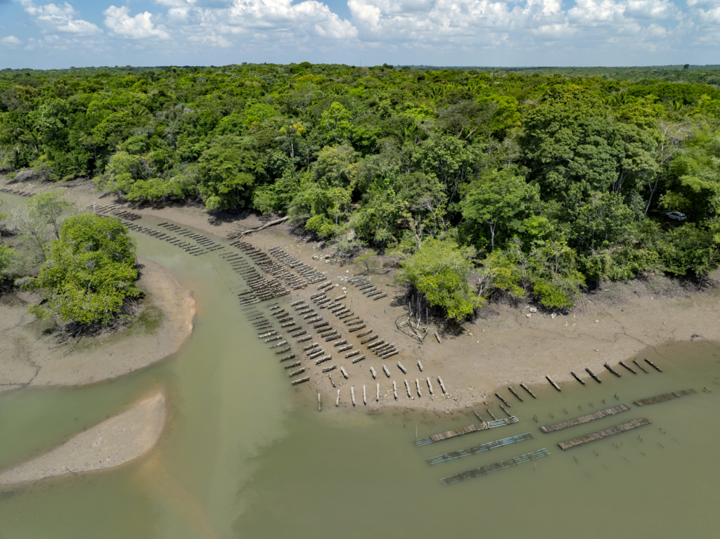
Building a clearer picture of a changing coast
For generations, ecological knowledge has guided decision-making for local Amazonian communities. But storm surges and rising temperatures are making it more difficult to predict what tomorrow will bring.
Members of Aquavila know how consequential those changes can be. In 2019, heavy rainfall caused a sudden drop in salinity that killed nearly all of their oysters.
“In the past, I collected oyster seeds at salinity 18,” said José Galvão, a leading Aquavila member who grew up in the Vila Lauro Sodré community. “Today it’s 8 or 7.”
Despite experiencing climate change firsthand, many communities along the Amazon coast remain underserved by monitoring infrastructure and climate investments. ARCA is working to close that information gap from both ends: improving how changing coastal conditions are observed and making those observations more useful to the people whose livelihoods depend on them.
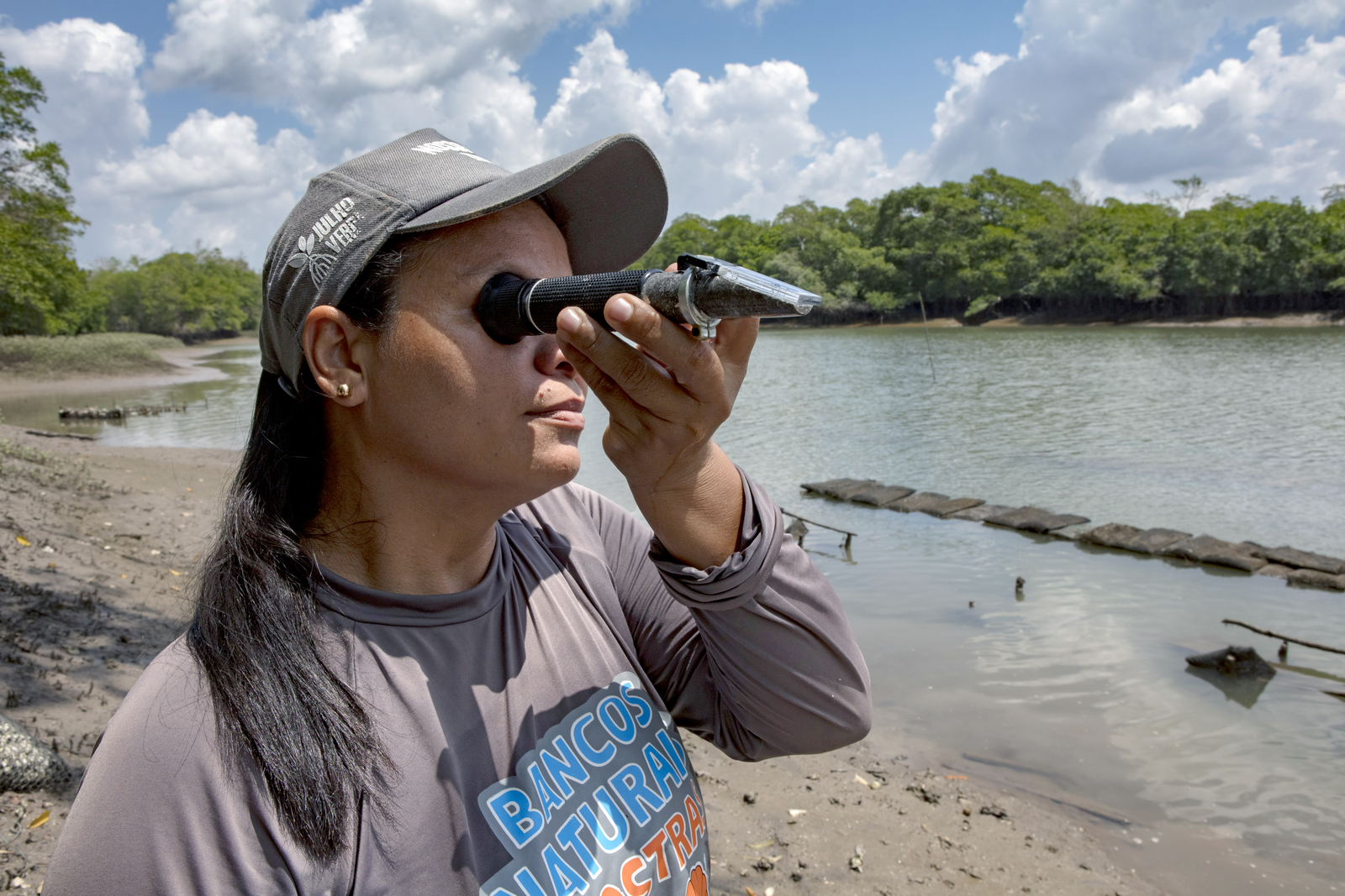
Oceanographic stations installed by LAPMAR/UFPA in the Mãe Grande de Curuçá Marine Extractive Reserve measure tide, salinity, wind, water temperature, and rainfall directly in coastal waters. Satellite analysis developed by Accenture extends monitoring to areas local stations can’t reach.
IAsmin bridges the final gap between environmental data and everyday decision-making. Developed for Rare by Accenture, the AI-powered tool translates complex environmental information into simple, hyperlocal forecasts delivered through WhatsApp. Combining these local and remote-sensing data, IAsmin will be able to offer a more complete picture of coastal conditions to communities across a much wider stretch of the Amazon coast.
At this time, participating users receive reports on tides and tidal changes via text or audio, making the forecasts accessible to people with varying literacy levels. Rare and its partners are working to incorporate additional environmental information soon, including rainfall, salinity, water temperature, and other indicators that affect coastal livelihoods.
From forecasts to everyday decisions
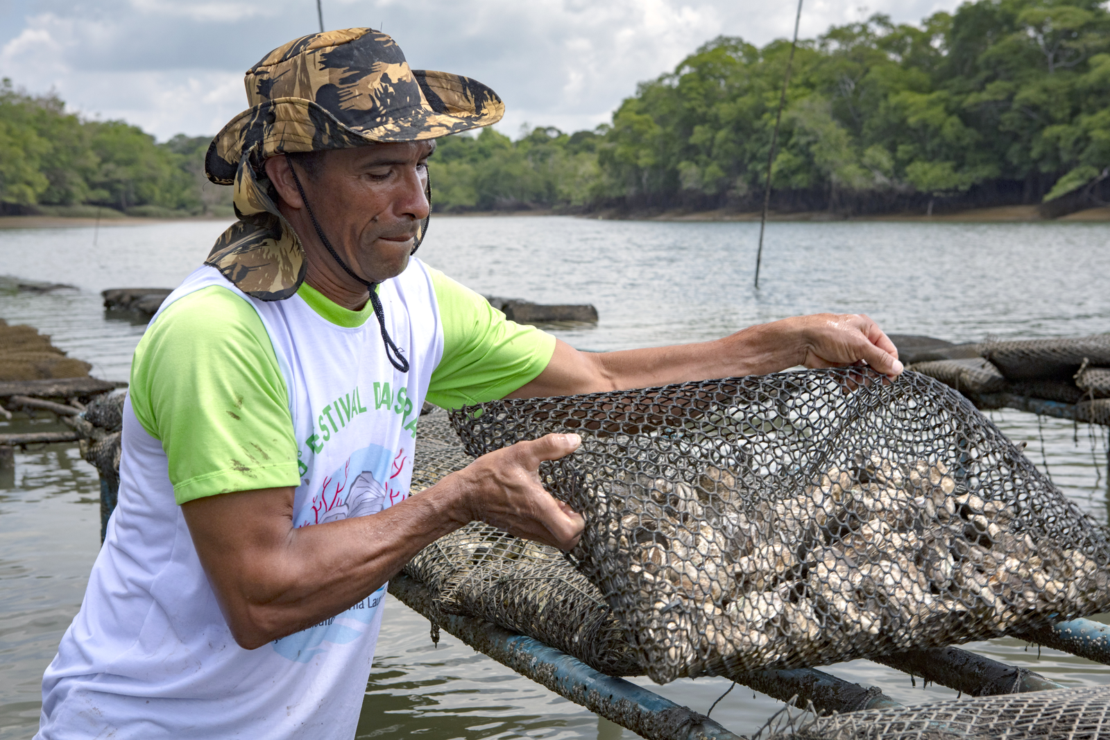
Early results suggest that the technology is already finding a place in the Aquavila association’s daily life. Participating families say the IAsmin forecasts help them schedule work around the tides with more lead time, freeing up hours for fishing, farming, and household tasks. Some also use the information to make safer decisions, such as where to leave a canoe as water levels change or when to head back from the oyster farm before conditions become risky. “I receive the audio with all of the information about what I need to do today,” said Taciara.
The oyster farmers also report that IAsmin’s tide information matches what they see in the field. On occasion, when a participating member misses the alert, most still trust their own reading, a sign that the tool complements local knowledge rather than replacing it.
The information provided by IAsmin is also starting to travel beyond their phones. Family members who do not receive the messages directly often hear about them from relatives participating in the pilot.
Strengthening climate adaptation and community resilience
During a recent workshop with Rare, Aquavila members reviewed the latest IAsmin findings and shared feedback to help improve the technology. “This opportunity to hear the findings was very valuable because we learned how the technology is increasingly contributing to our monitoring efforts, both in oyster production and ecological monitoring,” shared Taciara.
As the pilot expands to additional communities and livelihoods, like crabbers and matapi shrimp harvesters on Marajo Island, Rare is working with local governments to explore how the data can support broader climate adaptation efforts. Government officials see potential to use environmental data to monitor coastal erosion, anticipate flooding and drought, and build the evidence needed to secure climate funding.
Future technology features may also include early-warning alerts that combine rainfall and tide data to identify heightened flood risk, giving communities and local authorities more time to prepare before dangerous weather events. “Tools like IAsmin empower fishers and coastal communities along Brazil’s Amazon coast to make safer, faster livelihood decisions while strengthening public-sector climate adaptation,” shared Monique Galvão, Vice President of Rare Brazil.
For Taciara, the greatest value of the partnership lies in strengthening her community’s ability to care for the ecosystems and livelihoods they depend on. “Having partners like Rare consistently working alongside our community to achieve these results means a great deal to us,” she said. “It reinforces how important it is to protect our natural oyster banks so that in the future, we can see the full potential of oyster farming. It’s about preserving and caring for both our mangroves and our oceans.”
Written by: Kaila Ferrari
Edited by: Larissa Hotra